Sunday, July 25, 2010
Friday, July 23, 2010
Thursday, February 4, 2010
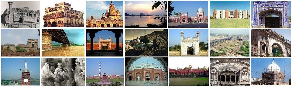
Chiniot: Chenab-nagar Bridge

On river Chenab a two-storey bridge was constructed in 1932 during the British rule (1857-1947) in the sub-continent. Its upper portion was used for traffic road while the lower portion in use for railway traffic.
 Due to dillipated condition of upper portion, in new one way bridge was constructed on river which was in granted by the Punjab government on 29th June 2000. The lower portion, a mammoth steel structure still provides a transportation facility for railway. It is standing on pillars are supporting this large bridge, and helping it to stand tall and laid horizontally on them. It is manifestation of durability which was a pivotal feature of architecture and construction of past.
 The Imperial Gazetteer of India
Physical Aspects
It is district in the Multan division of the Punjab lying between 300 35’ and 32 4 N, and 73 31 E, with an area of 6652 square miles. It is bounded on the north-west by district Shahpur, on the north-east by Shahpur and Gujranwala, on the south-east by Montgomery, on the south by Multan and Muzaffergarh and on the west by Mianwali. It consists of an irregular triangle, artificially constituted for administrative purposes from portion of three separate tracts.
The climate of Jhang is that of the South-West Punjab, the rainless tract comprising Multan, Montgomery, and Dera Ismail Khan, which is said to have the highest mean temperature in India between June and August. The dry air makes the District unusually healthy, except in the canal tracts, where it is malarious and trying to Europeans. The annual rainfall is light, ranging from 8 inches at Shorkot to 11 at Chiniot.
History
In modern times the history of Jhang centres in the tribe of the Sials, who ruled over a large tract between Shahpur and Multan, with little dependence on the imperial court at Delhi, until they finally fell before the power of Ranjit Singh. The Sials are Muhammadans of Rajput descent, whose ancestor, Rai Shankar of Daranagar, migrated early in the thirteenth century from the Gangetic Doab to Jaunpur. His son, Sial, in 1243 left his adopted city for the Punjab, then over- run by Mongol hordes. Such emigrations appear to have occurred frequently at the time, owing to the unsettled state of Northern India. During his wanderings in search of a home, Sial fell in with the famous Muhammadan saint Baba Farld-ud-din Shakarganj, of Pakpattan, whose eloquence converted him to the faith of Islam. He afterwards sojourned for a while at Sialkot, where he built a fort, but finally settled down and married at Sahiwal, in Shahpur District. It must be confessed, however, that his history and that of his descendants bear somewhat the character of eponymous myths. Manik, sixth in descent from Sial, founded the town of Mankera in 1380; and his great-grandson, Mai Khan, built Jhang Sial on the Chenab in 1462. Four years later, Mai Khan presented himself at Lahore, in obedience to a summons, and obtained the territory of Jhang as an hereditary possession, subject to a payment of tribute to the imperial treasury. His family continued to rule at Jhang, with the dynastic quarrels and massacres usual in Indian annals, till the beginning of the last century.
POPULATION
Meanwhile the Sikh power had arisen in the north, and Karam Singh Dulu, a chief of the Bhangi confederacy, had conquered Chiniot. In 1803 Ranjit Singh took the fort there and marched on Jhang, but was bought off by Ahmad Khan, the last of the Sial chieftains, on promise of a yearly tribute, amounting to Rs. 70,000 and a mare. Three years later, however, the Maharaja again invaded Jhang with a large army, and took the fort, after a desperate resistance. Ahmad Khan then fled to Multan, and the Maharaja farmed the territories of Jhang to Sardar Fateh Singh. Shortly afterwards, Ahmad Khan returned with a force given him by Muzaffar Khan, Nawab of Multan, and recovered a large part of his previous dominions, which Ranjit Singh suffered him to retain on payment of the former tribute, as he found himself too busy elsewhere to attack Jhang. After his unsuccessful attempt on Multan in 1810, the Maharaja took Ahmad Khan a prisoner to Lahore, as he suspected him of favoring his enemy, Muzaffar Khan. He afterwards bestowed on him a Jagtr, which descended to his son, Inayat Khan. On the death of the latter, his brother, Ismail Khan, endeavored to obtain succession to the Jagtr, but failed through the opposition of Gulab Singh. In 1847, after the establishment of the British Agency at Lahore, the District came under its charge, and in 1848 Ismail Khan rendered important services against the rebel chiefs, for which he received a small pension. During the Mutiny of 1857, the Sial leader again proved his loyalty by raising a force of cavalry and serving in person on the British side.
The presence of numerous mounds, especially in the south of the District, testifies to the former existence of a large and settled population. The remains which have received most attention are those at Shorkot, consisting of a huge mound of ruins surrounded by a wall of large-sized bricks. Most of the pre-Muhammadan coins that have been found here are of the Indo-Scythian period. The finest building in the District is the Shahi Masjid at Chiniot, built in the reign of Shah Jahan.
The population of the District at the last three enumerations was: (1881) 390,703, (1891) 432,549 and (1901) 1,002,656. It increased by no less than it2 per cent, during the last decade almost entirely owning to the opening of the Chenab Canal and the colonization of the canal tract. The District is divided into six tahsils: Jhang, Chiniot, Shorkot, Lyallpur, Samundri, and Toba Tek Singh. The head-quarters of each are at the place from which it is named. The towns are the municipalities of Jhang- Maghiana, the head-quarters of the District, Chiniot, and Lyallpur. The table on the next page gives the principal statistics of population in 1901.
Muhammadans form 68 per cent, of the total population, Hindus 24 per cent., and Sikhs 7 per cent. The density is only i5o-7 persons per square mile, which is considerably below the average (209) for the British Punjab. The language of the nomad tribes who originally inhabited the Bar is called Jangli, a form of Western Punjabi. Every variety of Punjabi is represented among the colonists.
The most numerous tribe is that of the Jats, who number 231,000, or 23 per cent, of the total population. Next to them in numerical strength come the Rajputs, numbering 90,000, and then the Arains with 62,000. Other important agricultural tribes are the Balochs (29,000), Khokhars (24,000), and Kambohs (11,000). The Saiyids number 10,000. The Aroras (68,000) are the strongest of the com- mercial classes, the Khattrls returning 21,000. The Brahmans number 9,000. Of the artisan classes, the Julahas (weavers, 40,000), Kumhars (potters, 32,000), Mochis (shoemakers and leather-workers, 29,000), Chamars (shoemakers and leather-workers, 23,000), Tarkhans (carpenters, 23,000), and Lobars (blacksmiths, 10,000) are the most important; and of the menials, the Chuhras and Musallis (sweepers and scavengers, 105,000), Machhis (fishermen, bakers, and water-carriers, 21,000), Nais (barbers, 13,000), and Dhobis (washermen, 10,000). Other castes worth mentioning in view of their numerical strength are the Mirasis (village minstrels, 16,000) and Fakirs (mendicants, 13,000). About 49 per cent, of the people are supported by agriculture.
The Church Missionary Society began work in the District in 1899, and has two stations, at Gojra and Toba Tek Singh. A considerable number of native Christians are scattered through the villages of the colony. At the last Census (190 1) the number of Christians in the colony was 8,672. The Church Missionary Society owns two villages: Montgomerywala, the larger, where there is a native church, with a population of 1,021; and Batemanabad, with a population of 337. The Roman Catholics hold the villages of Khushpur, founded in 1899 (population, 1,084), and Francispur, founded in 1904. The American Reformed Presbyterians have a mission at Lyallpur established in 1894, and they were followed by the American United Presbyterians in 1896. A few Salvationists are settled at Lyallpur and the neighboring villages.
Agriculture
The soil is an alluvial loam, more or less mixed with sand; but agricultural conditions depend not on distinctions of soil, but on the facilities afforded for irrigation, and less than one per cent, of the cultivation is unirrigated. At the same time the District, while not dependent on the rainfall, benefits largely by seasonable rain, which enables cultivation to be extended by supplementing the supply available from irrigation, and also secures an abundant supply of fodder.
More than half the area of the District, or 3,531 square miles, is the property of Government. Of this area, nearly two-thirds is leased to crown tenants in the Chenab Colony, and a large portion of the remainder will soon be commanded by the Jhelum Canal and leased to tenants. The Thai alone will thus remain uncultivated. Nearly all the proprietary villages are held by communities of small peasant owners. The area in square miles under each of the principal food- grains in 1903-4 was: wheat, 1,333; great millet, 170; and maize, 143. The principal non-food crop is cotton (354). Oilseeds covered 188 square miles.
The construction of the Chenab Canal has entirely revolutionized the agricultural conditions of the uplands between the Chenab and Ravi, and the Jhelum Canal is doing the same for the Bar north of the Jhelum. Thus the District, once one of the most sterile and thinly populated, is now one of the first in the Punjab, in both cultivation and population. The experimental farm at Lyallpur, established in 1901, is chiefly utilized for the study of Punjab crops, and their improvement by cross-fertilization and selection ; but it has hardly been in existence long enough to produce any result as regards the quality of the crops generally grown in the District. In spite of the important part played by wells in the cultivation of the lowlands, loans for their construction are not popular. Twelve lakhs were advanced under the Land Improvement Loans Act during the five years ending 1 901 ; but these advances were taken almost entirely by incoming colonists, to pay expenses due from them to Government under a system which has now been given up.
Before the introduction of canal-irrigation, the population of the Bar was largely pastoral. The breed of cattle, however, was never greatly esteemed, and the large numbers now required for agricultural purposes are purchased from outside the District. Cattle fairs are held at Jhang and Lyallpur. The District is famous for its horses, and a good deal of horse-breeding is carried on. The Remount department keeps nine and the District board seven horse stallions, and the District contains more than 1,000 branded mares. Ten donkey stallions are kept by the Remount department and four by the District board. Important horse fairs are held at Lyallpur and Jhang. A large number of camels are bred, and many of the colonists are bound by the conditions of their grants to furnish camels for transport work when required. Sheep and goats are kept in large numbers.
Of the total area cultivated in 1903-4, 2,799 square miles were irrigated, 453 square miles being supplied from wells, 23 from wells and canals, 2,319 from canals, and 4 from streams and tanks. In addition, 154 square miles, or 5 per cent, of the cultivated area, are subject to inundation from the rivers. The great mainstay of the District is the Chenab Canal. The greater part of the country irrigated by this canal was originally Government waste, and now forms part of the Chenab Colony, which occupies nearly half the total area of the District. In the colony canal-irrigation is but little supplemented by wells, and the old wells in the canal tract have mostly fallen into disuse. The District contains 15,980 masonry wells, chiefly found in the riverain lands, all worked with Persian wheels by cattle, besides 332 lever wells, water-lifts, and unbricked wells.
The District is devoid of true forests; but the Government waste, not included in the colony, which is under the control of the Deputy- Commissioner, is still extensive. The largest area is the Thai desert, in the Sind-Sagar Doab, which covers about 400 square miles. A great deal of tree-planting has been done in the colony.
The only mineral product of any importance is the stone quarried from the Chiniot hills.
TRADE AND COMMUNICATIONS
The town of Chiniot is famous for its carpentry and wood-carving and ornamental articles of furniture are made of brass inlay and marquetry. Good saddlery and locks are made at Jhang and Maghiana, and a great deal of cotton communications. Cloth is woven throughout the District. Preparing raw cotton for export is a flourishing business; and the District contains 10 cotton-ginning factories, 6 cotton-presses, 5 combined ginning and pressing factories, a combined ginning factory and flour-mill, a combined press and flour-mill, an iron foundry, and a flour-mill. The iron foundry and the flour-mill, which are situated at Lyallpur, were closed in 1904, but the rest of the mills and factories mentioned employed 1,220 hands in that year. They are all situated within the Chenab Colony and also within the new Lyallpur District. Three of the ginning factories and one of the presses are at Chiniot Road, a small town that has sprung up at the railway station nearest Chiniot; and two of the combined ginning and pressing factories and the combined press and flour-mill are at Toba Tek Singh, while the rest are divided between Lyallpur and Gojra.
The town of Lyallpur is one of the chief centres of the wheat trade. in India, and the District exports large quantities of wheat, cotton, oil- seeds, and other agricultural produce. Iron, timber, and piece-goods are the chief articles of import.
The Wazirabad-Khanewal branch of the North-Western Railway runs through the middle of the District, and carries the heavy export of agricultural produce from the Chenab Colony. The Southern Jech Doab Railway, which crosses the Chenab 10 miles above Jhang, joins the former line in the south of the District. It carries the produce of the villages irrigated by the Jhelum Canal, and places the town of Jhang in communication with the main line. The total length of metalled roads is 15 miles and of unmetalled roads 1,795 miles. Of these, 5 miles of metalled and 58 miles of unmetalled roads are under the Public Works department, and the rest are maintained by the District board. The Jhelum is crossed by nine ferries, and the Chenab by nineteen above and below its confluence with the Jhelum, There is but little traffic on these rivers.
There is no record of famine in Jhang District. Although the various droughts which have visited the Punjab in the past must have caused great mortality in cattle, famine on a large scale was impossible owing to the absence of unirrigated cultivation and the sparseness of the population. The construction of the Chenab Canal has now not only made the District able to support a large population in perfect security, but has turned it into the principal granary of the Province.
Administration
The Deputy-Commissioner as District Magistrate is responsible for criminal justice. Judicial work is under a District Judge, and both officers are supervised by the Divisional Judge of the Shahpur Civil Division, who is also Sessions Judge. There are three Munsifs, two at head-quarters and one at Chiniot, and one honorary magistrate.
Cattle-theft is the commonest form of serious crime.
The Sial chiefs of Jhang appear to have taken a fourth of the produce in kind as their share. In 1831 Sawan Mai's rule over the Multan Province began. His system of combined cash and kind rents enhanced by numerous cesses is described in the article on Multan District. The Kalowal tract, which lay west of the Chenab, was administered by Raja Gulab Singh; and as he exacted as much as he could in the shortest possible time, the development of this part of the District was greatly retarded.
In 1847-8 the first summary settlement was made before annexation. The basis was a reduction of 20 per cent, on the realizations of the Sikhs. At first the revenue was easily paid, but the sharp fall in prices which followed annexation caused great distress, and even desertion of the land. The second summary settlement, made in 1853, resulted in a reduction of 18 per cent. In Kalowal the first assessment had broken down utterly, and was revised in three days by the Com- missioner, Mr. Thornton, who reduced the demand from one lakh to Rs. 75,000 in 185 1. In 1853 he remitted Rs. 12,000 more, and the remaining Rs. 63,000 was easily paid.
In 1855 the regular settlement was begun. Government land was demarcated, a process simplified by the readiness of the people to part with their land and its burdens on any terms. The demand was fixed at 2 lakhs, while Kalowal (now in the Chiniot tehsil, but then a part of Shahpur District) was assessed at Rs. 33,000. Generally speaking, the demand was easily and punctually paid. A revised settlement was carried out between 1874 and 1880, fixed assessments being sanctioned for the flooded lands of the Chenab and Jhelum, and a fluctuating assessment for the Ravi villages, since transferred to Multan District. In certain parts of the District each well was assessed at a fixed sum. The total demand was 3-5 lakhs, an increase of 26 per cent. The rates of last settlement ranged from R. 0-8-0 to Rs. 1-6-4 ^^ ' wet ' land, the ' dry ' rate being R. 0-8-0.
During the currency of this settlement the enormous Government waste between the Chenab and Ravi rivers, known as the Sandal Bar, almost the whole of which is at present included in Jhang District, has come under cultivation by the aid of the Chenab Canal. The present revenue rate in this tract is 8 annas per acre matured. The extension explains the recent enormous rise in the land revenue demand, which was 2 2-3 lakhs in 1903-4, almost the whole of the fluctuating demand being realized from the new cultivation in the Sandal Bar. The ad- ministration of the Government land was under a separate Colonization officer until 1907, but the old proprietary villages of the District came again under settlement in 190 1. It was estimated that an increase of Rs. 1,12,000 would be taken; but this will probably be largely exceeded, owing to extensions of the Chenab Canal and to the introduction of canal-irrigation on the right bank of the Chenab from the Jhelum Canal.
The District contains the three municipalities of Jhang-Maghiana, Chiniot, and Lyallpur, and the three ' notified areas ' of Ahmadpur, Shorkot, and Gojra. Outside these, local affairs are entrusted to the District board. The income of the board, derived mainly from a local rate, was 3 lakhs in 1903-4, and the expenditure 2-5 lakhs. The largest item of expenditure was public works.
The regular police force consists of 834 of all ranks, including 149 municipal police, under a Superintendent, who usually has 3 inspectors under him. The village watchmen number 815. There are 11 police stations, 3 outposts, and 10 road-posts. The District jail at head-quarters has accommodation for 302 prisoners.
The percentage of literate persons in 1901 was 3-6 (6-3 males and 0-3 females), the District standing seventeenth among the twenty-eight Districts of the Province in this respect. The proportion is highest in the Jhang tehsil. The number of pupils under instruction was 2,243 in 1880-1, 4,686 in 1890-r, 6,108 in 1900-1, and 8,275 in 1903-4. In the last year the District possessed 5 secondary, 98 primary (public) schools, and one 'special' school, with 19 advanced and 210 elementary (private) schools. The proportion of girls is unusually large, there being 611 female scholars in the public, and 535 in the private schools. The only high school in the District is at Jhang town. The total expenditure on education in 1903-4 was Rs. 46,000, the greater part of which was met from Local funds and fees. Besides the civil hospital and branch dispensary at Jhang-Maghiana, the District has 12 outlying dispensaries. In 1904 the number of cases treated was 132,374, of whom 2,201 were in-patients, and 6,395 operations were performed. The expenditure was Rs. 24,000, the greater part of which was contributed by Local and municipal funds.
The number of persons successfully vaccinated in 1903-4 was 30,073, representing 30 per 1,000 of the population. Vaccination is compulsory only in the municipality of Jhang-Maghiana.
[D. C. Ibbetson, Jhang District Gazetteer (1883-4) and L. Leslie Jones; Chenab Colony Gazetteer (1905) E. B. Steedman, Jhang Settlement Report (1882).]
Jhang Tehsil. — Tehsil of Jhang District, Punjab, lying between 31° o' and 31° 47' N. and 71" 58'' and 72° 41'' E., with an area, since the formation of Lyallpur District in 1904, of 1,421 square miles. The Jhelum enters the tehsil on the north-west and the Chenab on the north-east, and they meet towards the south. The population in 1901 was 194,454. It contains the town of Jhang-Maghiana (population, 24,382), the head-quarters, and 448 villages. The land revenue and cesses in 1905-6 amounted to Rs. 2, 56,000. The tehsil extends into the Chenab Colony on the east; and a strip of the Sandal Bar, still in its pristine state, lies between the rich villages of this part and the cultivated lowlands on either side of the Chenab. Beyond these, waste alternates with cultivation, due to the farthest extensions of the Jhelum Canal, until the Jhelum lowlands are reached, studded with prosperous villages, situated among palm groves. The western border lies within the sandy desert of the Thai.
Jhang-Maghiana. — Head-quarters of the District and tehsil of Jhang, Punjab, situated in 31° 18'' N. and 72*^ 20'' E., on the Jech Doab extension of the North-Western Railway. Population (1901), 24,382, of whom 12,189 are Hindus and 11,684 Muhammadans. The towns of Jhang and Maghiana lie two miles apart, connected by metalled roads, but form a joint municipality. The Chenab flows at a distance of about three miles to the west ; but in the hot season the Kharora branch of the river runs close past both towns, and with its fine avenue of trees, three miles long, and handsome masonry bathing ghats, adds a peculiar beauty to the neighborhood. The country round is well wooded, and fine gardens abound. An inundation canal leaves the Kharora branch of the Chenab near Jhang, and, passing round Maghiana, empties itself into the same branch after a course of 5 miles. Maghiana lies on the edge of the highlands, overlooking the alluvial valley of the Chenab, while the older town of Jhang occupies the lowlands at its foot. Jhang is said to have been founded in the fifteenth century, and to have been destroyed by the river and refounded in the reign of Aurangzeb. It was taken by Ranjit Singh in 1805. The Government offices and establishments have now been removed to the higher site, and commerce has almost deserted Jhang, which is no longer a place of importance. Jhang-Maghiana was constituted a municipality in 1867. The income during the ten years ending 1902-3 averaged Rs. 46,800, and the expenditure Rs. 44,200. In 1903-4 the income was Rs. 49,700, mainly derived from octroi; and the expenditure was Rs. 50,200. Maghiana has a considerable trade in grain and country cloth, and manufactures leather, soap, locks and other brass-work. There is a civil hospital at Maghiana, and a high school and a dispensary at Jhang.
Bazars, roads and chowks of Chiniot
1. Muslim Bazaar
2. Rail Bazaar
3. Kachehry Bazaar
4. Sarafa (Goldsmith) Bazaar
5. Mandar (Temple) Bazaar
6. Dakkhana (Post-office) Bazaar
FAMOUS CHOWKS OF CHINIOT
1. Tehsil Chowk
2. Paapera Chowk
3. Qasaban Chowk
4. Rajoa Chowk
5. Jhumra Chowk
6. Ghala-mandi Chowk
7. Tarkhana Chowk
8. Eid-gah Chowk
9. Jathothan Chowk
10. Grah mosque Chowk
11. Ghanta-ghar Chowk
FAMOUS ROADS OF CHINIOT
1. Faisalabad Road
2. Sargodha Road
3. Lahore Road
4. Quaid-e-Azam Road
5. Jhang Road
6. Sahianwala Road
7. Chinioti Road
8. Moazzam-shah Road
9. Haqania Road
10. Salara Road
11. City Thana Road
12. Alimgir Road
13. Jhumra Road
14. Eid-gah Road
15. Chikri-wala Road
16. Club Road
17. Shalimar-park Road
CHRONOLOGY OF CHINIOT HISTORY
CHRONOLOGY OF CHINIOT HISTORY
(Saeed Mashaal Bhatti)
1003 Jevan Tanda was ruler of the state of Chiniot
1206 Jakh was Governor of the region
1290 Urkali was ruler of
1296 Nusrat Khan was governor of
1298 Alla-ud-din Khilji first time measurement of the land of sub-continent
1298 Qatlakh Khawja attacked the area and massacre of people
1307 Fight between Sardar Tartak and Sultan Taghluq Baig
1326 fort was constructed in Chiniot by Sultan Muhammad Taghlaq
1389 Sardar Mughali ruler of Chiniot attacked state of Khushab
1391 ‘Chani’ attacked the city and set the city on fire
1398 Mughal Sardar Tartar attacked the city during the rule of ‘Chani’
1400 The tradition of displaying Tazia as a replica of the Imam's shrine was introduced to
1430 Mirza Shahrukh attacked the area during the regime of Sultan Shah Lodhi
1519 Babar marched through Attock and crossed the Soan on his way to Khushab, Bhera and Chiniot.
1526 Younas Ali governor of
1540 Kamran Mirza Governor of
1605 Birth of Nawab Wazir Khan
1609 Birth of Nawab Sa’adullah khan in Patraki a near by town
1634 Mosque Wazir Khan was built by Aleem-ud-din Insari, Nawab Wazir khan
1641 Death of Nawab Wazir khan due to , buried in Akbarabad
1646 Construction of Badshahi Mosque in the city
1655 Masons of the town are said to have been employed during the construction of Taj Mahal Agra and Golden Temple Amritsar
1655 Death of Nawab Sa’adullah Khan due to
1671 Main Khan during the reign of Aurangzeb and was buried inside this baradari.
1762 Hari Singh also led his expeditions to Chiniot and Jhang
1765 On his way back home, Hari Singh reduced Jharig, Chiniot and
1772 Lalian was found by Hafiz Muhammad Sadeeq Lali
1782 Desu Singh marched to reduce Chiniot and had many skirmishes with the Sukarchakia chief, Mahan Singh
1803 Ranjit Singh marched against that fort and captured it
1852 Village and Chack Demarcation in Chiniot
1855 The regular settlement was begun. Government land was demarcated, a process simplified by the readiness of the people to part with their land
1856 Chiniot was given status of Tehsil (District Jhang and Multan Division)
1860 Registration of the land (incomplete)
1868 Total Population of Tehsil Chiniot was 1, 09, 472 souls according to census
1868 Population of town of
1870 Police station was established in the city
1870 Municipality Welfare Committee (3rd class)
1871 First census in
1875 Population of town of
1877 Chiniot Railway /
1878 Total Cultivated area of Tehsil was 73, 753 actrs
1878 Establishment of Dispensary (1st class) in Chiniot
1879 Railway track was laid down in the area from Salarwala to Eidalwala
1880 Establishment of telegraph office in Chiniot and Aminpur Bungalow
1880 Registration of the land in Chiniot
1881 2nd census in the
1881 Population of tehsil Chiniot was 128, 241 souls according to census
1882 Total Population 1, 28, 241 according to Census
1886 Instances of local development of goitre in the town of Chiniot
1887 Municipal committee (1st class) was established
1889 It is on the peeling, yellow-plastered walls of Chiniot that the first signs of the hatred directed against the Ahmadi community appear.
1892 Excavation of
1896 Excavation of
1898 First weekly Al-munir was launched by Ghulan Hussain Joya
1901 Construction of
1901 Population of tehsil Chiniot was 200, 676 souls according to census
1901 Population of town of
1904 A portion of the tahsil was incorporated in the new District of Lyallpur
1904
1908 Excavation of santo-wali canal (distributary of
1924 Foundation of
1927 Chiniot station was Established and once a big attraction for furniture traders and commuters because of trains' cheap fare and less travelling time.
1928 Construction of bungalow of Irrigation Department on canals
1932 Construction of two-storeyed bridge on river
1933 The Marh-Chiniot main drain and Rechna Extension drain were constructed as outfalls
1934 Railway track was laid down which connects city with
1942 Austerlitia Bank (changed to Allied Bank in 1972)
1948 National Bank of Pakistan (NBP) was established
1948 Excise and Taxation Office was established
1948 Rabwah (Chack Dhagian) was found near the river
1952 66/Kv electricity line was installed
1954 He founded his own seminary Jamia Arabiya in Chiniot
1955 Telephone was introduced in the region
1955 The Punjab Provincial Cooperative Bank was established
1956 Allama Mashraqi had addressed a public meeting under the auspices of the Islam League in Chiniot
1959 Establishment of Muslim Commercial Bank (MCB)
1959 United Bank Limited (UBL) was established
1960 Civil Hospital was established by upgrading the dispensary
1960 Chiniot Tehsil was affiliated with Sargodha Division
1966 Zarae Taraqiyati Bank (ZTB) was established
1968 Sui Gas pipe-line was installed in Chenabnagar
1976 introduction of Sui Gas in Chiniot city
1978 Post office was established in Chiniot
1978 Establishment of WAPDA office in the city (Division Status)
1978 Iqbal Rice Mill was established
1979 Civil Hospital was shifted in new building
1981 Total Population was 6, 94, 080 souls according to census
1981 Income and Wealth Tax Office was established
1982 Chiniot Tehsil was included in
1983 Office of Mining and Minerals Department was established
1991 Establishment of Bank of
1995 Establishment of PTCL office (Division status)
1998 Total Population was 9, 65, 124 souls according to census
1998 Tehsil Municipal Administration (TMA) structure was introduced
1998 Chiniot-Jhang road was constructed
1999 Rabwah (Chack Dhagian) was renamed as Chenabnagar
2006 In one incident, the government of
2009 Feb 2, Chief Minister Shahbaz Sharif has formally announced the upgradation of Chiniot tehsil as the 36th district of the province
Monday, January 18, 2010
State of Press Freedom in Pakistan
1. Public Safety Act, 1948
2. APP (Associated Press Pakistan)
3. Security of Pakistan act, 1949
4. Cancellation of declaration
2nd PHASE: AYUB & YAHYA REGIME (1958-1971)
1. Press & Publication Ordinance, 1960
2. Detention of News Editors
3. Press advice system
4. Central Press Consulate Council, 1966
5. Decade of development celebration
6. Election of 1970
3rd PHASE: BHUTTO REGIME (1971-1977)
1. Cancellation of Declaration
2. Shallow slogans of Press Freedom
4th PHASE: ZIA REGIME (1977-1988)
1. Black tunnel of journalism
2. Advertisement quota with favoritism
3. Martial Law Regulation (MLR)
4. Punishment of lashes, 1974
5. Censorship of new papers, 1979
6. Easier Declaration of newspapers, 1985
7. Mushroom growth of news papers
8. Black sheep of Professionalism
5th PHASE: BENAZIR & NAWAZSHRIF (1988-1999)
1. Tools to restrain press freedom
2. Observation of Black Day (1991)
3. Increase of duty on newsprint
4. Corruption & Malpractices
5. Conflict of Govt & Jang
6th PHASE: MUSHARAF REGIME (1999-2008)
1. Freedom of press
2. Charge of promoting obscenity
3. PEMRA, 2002
4. The press council of Pakistan Ordinance (2002)
5. Press Newspapers & News Agencies Registration ordinance (2002)
6. Judicial crisis
7. Election of 2008
8. Liberal way of being conservative
9. Lawyers Movement
10. Restoration of Judiciary
Communication: Barriers & Theories
1. Sender/Encoder
2. Channel
3. Noise
4. Message
5. Receiver/Decoder
6. Feedback
TYPES OF COMMUNICATION
1. Non-verbal Communication
2. Intrapersonal Communication
3. Interpersonal Communication
4. Mass Communication
5. Written Communication
BARRIERS OF COMMUNICATION
1. Dissonance
2. Channel Noise
3. Semantic Noise
4. Feedback Effect
5. Illiteracy
6. Energy-Electricity
7. Language
8. Field of Experience
9. Religion
10. Social/Cultural Norms
11. Prejudice & Stereotyping
THEORIES OF COMMUNICATION
1. Cognitive Theory of Communication (1951) Leon Festinger
2. Two step flow of Communication Model: Katz & Lazarsfeld
3. AMX model of communication (1953) Newcamb
4. SMCR communication model: David K. Berlo
5. Transactional model of communication (1970) Barnlund
6. Mathematical model of communication: Claude Shamon & Warren Weaver
7. Circular Model of communication (1954) Osgood & shramm
8. Cultivation theory of Communication: George Gerbner
9. Laswell model of communication (1964)
10. Helical model of communication (1967) Daneer
11. Mosaic model of Communication (1968)
MEANS OF MASS COMMUNICATION
1. Newspapers
2. Radio
3. Television
4. Film
5. Internet
6. Books
7. Pamphlets & Posters
8. Magazines
Sunday, January 17, 2010
Mass Media: Functions & Problems
1. Discovering Facts & Figures
2. Formulation of Public Opinion
3. Creating Critical Thinking
4. Agent of Socialization
5. Solution to Social & Economic Problems
6. Vehicle of peace & integrity
7. Trend-Setting
8. Mechanism of Check & Balance
9. Entertainment & Recreation
10. Voice of General Masses
11. Education
12. Patronizing Social Norms & Values
13. Agent of Social Change
14. Eradicating stereotypes & Prejudices
15. Vehicle of Cultural Transformation
16. Launching Mass Movements
17. Condemning Racial Discrimination
18. Respecting National Interest
19. Fundamental Human Rights
20. Constructive Criticism
DISADVANTAGES/ BANES OF MASS MEDIA
1. Yellow Journalism
2. Damaging National Interest
3. Promoting Feeling of Separation
4. Aggrandizement of Issues
5. Triggering Sense of Disobedience
6. Disinformation
7. Stimulating Confrontations
8. Challenging The Writ of State
PROBLEMS FACED BY MASS MEDIA
1. Sever Regulatory Laws
2. Freedom of Speech
3. Possession of News Papers & Channels
4. Mutual Competition
5. Salaries of Journalist
6. Yellow Journalism
7. Pressure Group
8. Press Advice
9. Lack of Infrastructure
10. Professional Jealousy
11. Political Instability
12. Social Problems
13. Harassment & Physical Threats
14. Exploitation & Blackmailing
15. Environmental Insecurity
16. Military Interventions
Economic Crisis: Causes & Impact
1. Fledgling Condition of Stock Markets
2. Credit Crunch
3. Shriveling Foreign Reserves
4. Burgeoning Trade & Fiscal deficit
5. Hyperinflation
6. Rupee Devaluation
7. Issue of Balance of Payments
FACTORS OF ECONOMIC CRISIS
1. Policy of Deregulation
2. Unplanned Financial & Capital Market Liberalization
3. Excessive Subsidies on Fertilizers & Petroleum Products
4. Loose Monitory Policy
5. Worldwide Food Shortage
6. Load-shedding
7. Stress of Provinces & Federal
8. Dependency on External Debts & Foreign Aids
9. Strategy of Quick-fix Solution
10. Impact of Global Economic Turmoil
11. Shift in Demands of Products
12. Myth of Balloon Development
13. Deteriorating Law & Order
14. War of Terrorism
IMPACTS OF ECONOMIC CRISIS
1. Social Ferment & Confusion
2. Burgeoning Trade Deficit
3. Unemployment
4. Rupee Devaluation
5. Hyper-inflation
6. Business Fluctuations
7. Credit Market Paralysis
8. Downfall of Stock Markets
9. Trust Deficit of Investors
10. Food Shortage
11. Crisis of Balance of Payments
12. Malnutrition
13. Poverty
AILMENTS OF ECONOMIC CRISIS
1. Strategy of Economic Partners
2. Pragmatic Use of Agricultural Sector
3. Ameliorating Tax Collection Mechanism
4. Escaping Dependence of Economic Institutions (IMF)
5. Disaster Management system
6. Refurbishment of Power Structure
7. Increase in Foreign Exchange Reserves
8. Controlling Burdon of External Debts & liabilities
9. uniform National Economic Strategy
10. Catering Energy Crisis
11. Expunging Influence of Petroleum Products Dependency
12. Political Stability
13. Enticing Foreign Direct Investment
14. Increasing Foreign Remittance
15. Enhancing Growth Rates
16. Parliament Supremacy in Goal Setting
17. Provincial Autonomy in Raising Resources & Formulating Plans
18. Planning Economic Commission's Formulation of Strategy
Energy Crisis: Impacts & Preventions
MYTH OF ENERGY CRISIS
1. Shortage of Electricity
2. Dwindling Share of Local Oil & Gas
3. Insecurity of Supplies
4. Intensifying Global Competition of Petroleum Resources
ENERGY SECTORS
1. Industrial Sector
2. Domestic Sector
3. Commercial Sector
4. Transport Sector
FACTORS OF ENERGY CRISIS
1. Abuse of Official Transport
2. Depletion of Fossil Fuel Resources
3. Marginal Dependency on Energy Imports
4. Water Scarcity Issues
5. Techno-Economic Barriers
6. Bulging Population
7. Atmosphere of Insecurity
8. Political Instability
9. Development of the Basis of Inequality & Injustice
10. Social Intolerance
11. Burgeoning Trust Deficit
12. Deteriorating Law & Order
13. Strategy of Quick-fix Solution
14. Regional Disparities
15. Economic Exploitation
16. Adhoc Policy System
17. Lack of Risk Management System
IMPACT OF ENERGY CRISIS
1. Unemployment
2. Imbalance Growth Rates
3. Energy Imports Dependency
4. Widening Trust Deficit
5. Issue of Balance of Payments
6. Trade Deficit
7. Social Confusion
8. Inflation
REMEDIES OF ENERGY CRISIS
1. Rendering Legal Indemnity
2. Cost-effective Energy Conservation Programs
3. Energy efficiency in all sectors
4. Attitude Modification of Masses
5. Pragmatic Use of Available Resources
6. Expunging Influence of Energy Imports Dependency
7. Uniform National Energy Policy
8. Renewable Energy Resources
9. Overcoming Techno-economical Barriers
10. Structural Reforms & Legislations
11. Defeating Illiteracy
12. Parliament Supremacy in Setting Goals
13. Provincial Autonomy in Utilization of Resources
14. Effective Risk Management System
15. Development of Public Transport System
16. National Consensus
17. Good Governance
Chiniot: Architechtural History
Architecture is both the process and product of planning, designing and constructing space that reflects functional, social, and aesthetic considerations. It requires the manipulation and coordination of material, technology, light, and shadow. Architecture also encompasses the pragmatic aspects of realizing designed spaces, such as project planning, cost estimating and construction administration. A wider definition may comprise all design activity from the macro-level (urban design, landscape architecture) to the micro-level (construction details and furniture). Architectural works are often perceived as cultural and political symbols and as works of art. Historical civilizations are often identified with their surviving architectural achievements.
 Architects plan, design and review the construction of buildings and structures for the use of people by the creative organization of materials and components with consideration to mass, space, form, volume, texture, structure, light, shadow, materials, program, and pragmatic elements such as cost, construction limitations and technology, to achieve an end which is usually functional, economical, practical and often artistic. This distinguishes architecture from engineering design, which has as its primary object the creative manipulation of materials and forms using mathematical and scientific principles. As documentation produced by architects, typically drawings, plans and technical specifications, architecture defines the structure and/or behavior of a building or any other kind of system that is to be or has been constructed.
History of architecture
Origins and the ancient world
 Architecture first evolved out of the dynamics between needs (shelter, security, worship, etc.) and means (available building materials and attendant skills). As human cultures developed and knowledge began to be formalized through oral traditions and practices, architecture became a craft. Here there is a process of trial and error, and later improvisation or replication of a successful trial. What is termed Vernacular architecture continues to be produced in many parts of the world. Indeed, vernacular buildings make up most of the built world that people experience every day.
 Early human settlements were mostly rural. Due to a surplus in production the economy began to expand resulting in urbanization thus creating urban areas which grew and evolved very rapidly in some cases, such as that of Çatal Höyük in Anatolia and Mohenjo Daro in Pakistan. In many ancient civilizations, like the Egyptians' and Mesopotamians', architecture and urbanism reflected the constant engagement with the divine and the supernatural, while in other ancient cultures such as Persia architecture and urban planning was used to exemplify the power of the state. The architecture and urbanism of the Classical civilizations such as the Greek and the Roman evolved from civic ideals rather than religious or empirical ones and new building types emerged. Architectural styles developed.
The medieval builder
 Islamic architecture began in the 7th century CE, developing from a blend of architectural forms from the ancient Middle East and from Byzantium but also developing features to suit the religious and social needs of the society. Examples can be found throughout the Middle East, North Africa and Spain, and were to become a significant stylistic influence on European architecture during the Medieval period. In Europe, in both the Classical and Medieval periods, buildings were not attributed to specific individuals and the names of the architects frequently unknown, despite the vast scale of the many religious buildings extant from this period.
 During the Medieval period guilds were formed by craftsmen to organize their trade and written contracts have survived, particularly in relation to ecclesiastical buildings. The role of architect was usually one with that of master mason, or Magister lathomorum as they are sometimes described in contemporary documents. Over time the complexity of buildings and their types increased. General civil construction such as roads and bridges began to be built. Many new building types such as schools, hospitals, and recreational facilities emerged.
Renaissance and the architect
 With the Renaissance and its emphasis on the individual and humanity rather than religion, and with all its attendant progress and achievements, a new chapter began. Buildings were ascribed to specific architects - Brunelleschi, Alberti, Michelangelo, Palladio - and the cult of the individual had begun. There was still no dividing line between artist, architect and engineer, or any of the related vocations, and the appellation was often one of regional preference. At this stage, it was still possible for an artist to design a bridge as the level of structural calculations involved was within the scope of the generalist.
Early modern and the industrial age
With the emerging knowledge in scientific fields and the rise of new materials and technology, architecture and engineering began to separate, and the architect began to concentrate on aesthetics and the humanist aspects, often at the expense of technical aspects of building design.
 There was also the rise of the "gentleman architect" who usually dealt with wealthy clients and concentrated predominantly on visual qualities derived usually from historical prototypes, typified by the many country houses of Great Britain that were created in the Neo Gothic or Scottish Baronial styles. Formal architectural training in the 19th century, for example at Ecole des Beaux Arts in France, gave much emphasis to the production of beautiful drawings and little to context and feasibility. Effective architects generally received their training in the offices of other architects, graduating to the role from draughtsmen or clerks. Meanwhile, the Industrial Revolution laid open the door for mass production and consumption. Aesthetics became a criterion for the middle class as ornamented products, once within the province of expensive craftsmanship, became cheaper under machine production. Vernacular architecture became increasingly ornamental. House builders could use current architectural design in their work by combining features found in pattern books and architectural journals.
Modernism and reaction of architecture
The dissatisfaction with such a general situation at the turn of the twentieth century gave rise to many new lines of thought that served as precursors to Modern Architecture. Notable among these is the Deutscher Werkbund, formed in 1907 to produce better quality machine made objects. The rise of the profession of industrial design is usually placed here. Following this lead, the Bauhaus school, founded in Germany in 1919, consciously rejected history and looked at architecture as a synthesis of art, craft, and technology.
 When Modern architecture was first practiced, it was an avant-garde movement with moral, philosophical, and aesthetic underpinnings. Immediately after World War I, pioneering modernist architects sought to develop a completely new style appropriate for a new post-war social and economic order, focused on meeting the needs of the middle and working classes. They rejected the architectural practice of the academic refinement of historical styles which served the rapidly declining aristocratic order. The approach of the Modernist architects was to reduce buildings to pure forms, removing historical references and ornament in favor of functionalist details. Buildings that displayed their construction and structure, exposing steel beams and concrete surfaces instead of hiding them behind traditional forms, were seen as beautiful in their own right. Architects such as Mies van der Rohe worked to create beauty based on the inherent qualities of building materials and modern construction techniques, trading traditional historic forms for simplified geometric forms, celebrating the new means and methods made possible by the Industrial Revolution. Many architects resisted Modernism, finding it devoid of the decorative richness of ornamented styles. As the founders of the International Style lost influence in the late 1970s, Postmodernism developed as a reaction against the austerity of Modernism. Robert Venturi's contention that a "decorated shed" (an ordinary building which is functionally designed inside and embellished on the outside) was better than a "duck" (a building in which the whole form and its function are tied together) gives an idea of this approach.
Architecture today
Part of the architectural profession, and also some non-architects, responded to Modernism and Postmodernism by going to what they considered the root of the problem. They felt that architecture was not a personal philosophical or aesthetic pursuit by individualists; rather it had to consider everyday needs of people and use technology to give a livable environment.
 The Design Methodology Movement involving people such as Christopher Alexander started searching for more people-oriented designs. Extensive studies on areas such as behavioral, environmental, and social sciences were done and started informing the design process. As the complexity of buildings began to increase (in terms of structural systems, services, energy and technologies), architecture started becoming more multi-disciplinary. Architecture today usually requires a team of specialist professionals, with the architect being one of many, although usually the team leader. During the last two decades of the twentieth century and into the new millennium, the field of architecture saw the rise of specializations by project type, technological expertise or project delivery methods. In addition, there has been an increased separation of the 'design' architect [a] from the 'project' architect.[b] Moving the issues of environmental sustainability into the mainstream is a significant development in the architecture profession. Sustainability in architecture was pioneered in the 1970s by architects such as Ian McHarg in the US and Brenda and Robert Vale in the UK and New Zealand. There has been an acceleration in the number of buildings which seek to meet green building sustainable design principles. It is now expected that architects will integrate sustainable principles into their projects. An example of an architecturally innovative green building is the Dynamic Tower which will be powered by wind turbines and solar panels.
Indian Architecture
 Indian architecture encompasses a wide variety of geographically and historically spread structures, and was transformed by the history of the Indian subcontinent. The result is an evolving range of architectural production that, although it is difficult to identify a single representative style, nonetheless retains a certain amount of continuity across history. The diversity of Indian culture is represented in its architecture. It is a blend of ancient and varied native traditions, with building types, forms and technologies from West and Central Asia, as well as Europe. It includes the architecture of various dynasties, such as Hoysala architecture, Vijayanagara Architecture and Western Chalukya Architecture.